
The River Camel heads out to sea at Padstow. Camelford, I assume, once had a ford as a river crossing place. However, at 700 feet above sea level Camelford is actually one of the highest towns in England.
We can see that the River Camel is managed these days. This is because on August 30th 1950 the Market Place was flooded by several feet of water after a cloud burst. The present bridge replaced the original one in 1955 as part of the flood protection scheme.
Camelford has a town hall right alongside the busy main road which forms the main town street.
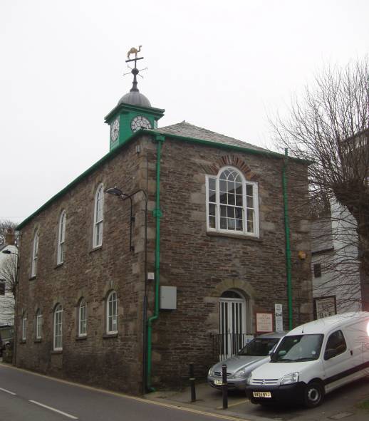
And atop the town hall is the clock and camel shaped weather vane.
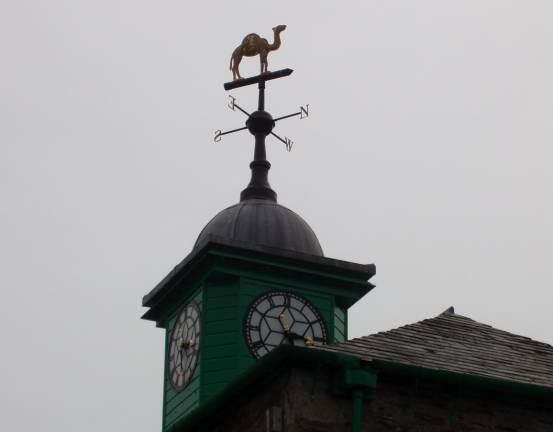
So what has the place got to do with camels? The answer is none. The name derives from cam = crooked stream, alan = beautiful and ford. Thus Camalanford, contracted in the course of time to Camelford. The river Cam (which in Celtic means crooked stream) was easily forded by early travellers. Records show that there has been a bridge here since 1521. But despite no connection with camels, the little town is happy to use them as an emblem – and why not!
In places the road is too narrow for present day traffic and so this has to be managed by traffic lights which allow alternating traffic to cope.

We did our shopping – a bit of milk and bread and some sausages to provide suppers and headed back to the North Coast.